
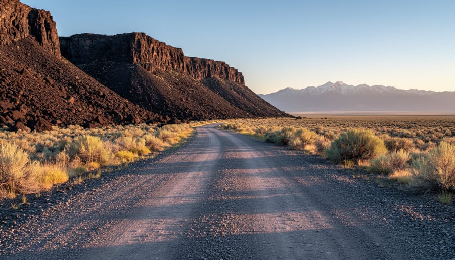
South Alamo Road is the gateway to one of the San Luis Valley’s best-kept secrets: the Alamosa South Bluff Trail system. This modest gravel access route leads adventurers from the outskirts of Alamosa directly to dramatic overlooks, hidden slot canyons, and volcanic rock formations that rival better-known Colorado destinations without the crowds. The road isn’t fancy, but what it delivers is pure high-desert magic.
Most visitors discover South Alamo Road while searching for the South Bluff trailhead, and that’s exactly its purpose. The road carves through sagebrush flats before climbing gently toward the striking basalt formations that define this landscape. You’ll find multiple pull-offs and trail access points along the way, each offering different perspectives on the valley floor stretching to the Sangre de Cristo Mountains beyond.
What makes this road essential isn’t just where it goes, but what it reveals along the journey. The transition from valley grasslands to rugged bluff country happens quickly, and first-time visitors are often surprised by the geological drama hidden just minutes from town. Local hikers know this route by heart, timing their drives for golden hour when the light sets the volcanic rock ablaze.
Whether you’re planning a morning hike, an afternoon photography session, or simply exploring what the San Luis Valley offers beyond the Great Sand Dunes, South Alamo Road is your starting point. Understanding the route, knowing what to expect, and planning for the conditions will transform a simple drive into the gateway to your next Colorado adventure.
Why South Alamo Road Matters for Alamosa Visitors
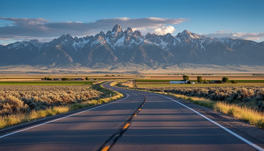
South Alamo Road serves as more than a simple dirt route to a trailhead, it’s the essential corridor that unlocks access to the Alamosa South Bluff Trail system and frames the entire San Luis Valley experience in a way few other local roads can. For visitors planning to explore the bluffs, this unpaved road transforms the journey into part of the adventure itself, with sweeping vistas unfolding as you climb toward the high desert terrain where the trail begins.
The drive along South Alamo Road showcases the raw beauty of the valley floor stretching below, flanked by the dramatic Sangre de Cristo Mountains to the east and the San Juan range to the west. On clear days, the visibility extends for miles, offering a perspective on Colorado’s largest alpine valley that’s rarely matched elsewhere in the region. This road gives you:
- Panoramic valley views stretching across the entire San Luis basin
- Direct trailhead access points to the South Bluff loop and extended routes
- Wildlife viewing zones where pronghorn, deer, and raptors are frequently spotted
- Outstanding photography viewpoints capturing sunset light and mountain silhouettes
Beyond reaching the main trailhead, South Alamo Road connects to a broader network of paths that branch into less-traveled territory for hikers seeking solitude. The elevated position provides natural overlooks where you can pause before or after your hike, making the road itself a worthwhile stop rather than just a means to an end. For anyone exploring Alamosa’s outdoor offerings, this route ties together multiple recreation opportunities while delivering scenic value that justifies the rough washboard sections you’ll encounter along the way.
Key Stops and Areas Along South Alamo Road
1. Alamosa South Bluff Trail Trailhead
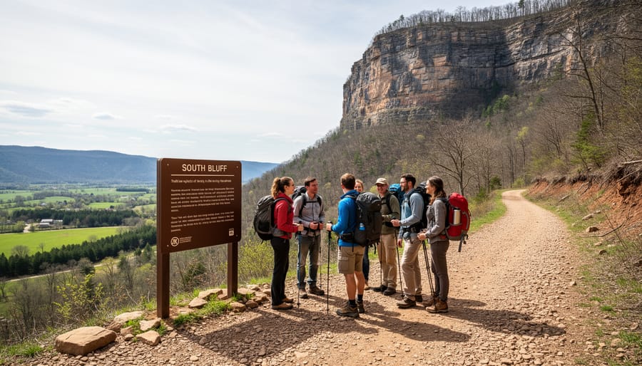
The Alamosa South Bluff Trail trailhead sits at the end of South Alamo Road, where a well-maintained gravel parking area accommodates about a dozen vehicles. You’ll find clear trail markers and an information kiosk displaying route maps and safety guidelines. The parking lot provides direct access to the main trail loop, which spans roughly 2.5 miles with moderate elevation gain of about 300 feet.
From the trailhead, hikers follow a wide, well-defined path that gradually ascends the bluff’s southern face. The terrain consists of packed dirt interspersed with volcanic rock fragments, remnants of ancient lava flows that shaped this dramatic landscape millions of years ago. These basalt formations create the distinctive stepped appearance of the bluff, offering natural platforms for rest stops and photography.
The trail’s first half-mile provides a steady but manageable climb suitable for most fitness levels. Families with older children regularly complete the loop in 90 minutes to two hours. As you gain elevation, sweeping views of the San Luis Valley open up to the west, with the Sangre de Cristo Mountains forming a jagged horizon line to the east.
The trail’s highest point delivers 360-degree panoramas encompassing the valley floor, distant mountain ranges, and on clear days, the Great Sand Dunes National Park approximately 30 miles northeast. Several rocky outcrops along the upper trail serve as natural overlooks where hikers pause to absorb the valley’s immense scale and photograph the layered sunset colors.
2. South Alamo Road Scenic Overlooks
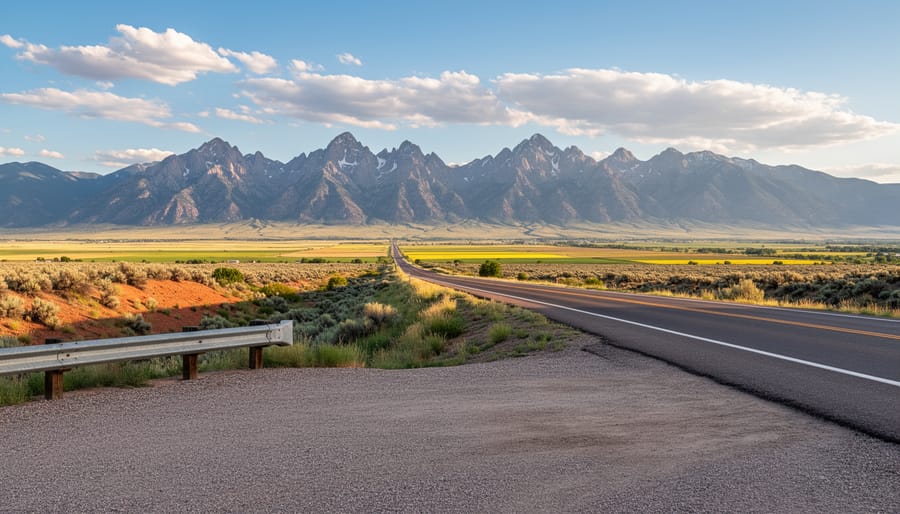
As you climb along South Alamo Road, you’ll find several natural pull-off areas where the pavement widens just enough to safely park and take in sweeping views of the San Luis Valley. These informal overlooks don’t have official signs or facilities, but they offer some of the best vantage points in the Alamosa area.
The western-facing overlooks provide unobstructed views across the valley floor toward the Sangre de Cristo Mountains. On clear days, you can see peaks stretching from Blanca Peak in the south to the Great Sand Dunes National Park area in the north. The elevation gain along the road means each successive pull-off reveals slightly different perspectives of the valley’s patchwork of agricultural fields and wild grasslands.
Timing matters here. Late afternoon and evening hours transform these spots into front-row seats for spectacular sunsets, when the mountains turn shades of purple and gold. Photographers favor the hour before sunset for warm light that brings out the texture in the valley landscape. Early morning visits offer crisp visibility and wildlife activity, though you’ll be shooting into the sunrise rather than capturing mountain alpenglow.
Winter and spring provide the clearest atmospheric conditions for distance views, while summer monsoon season brings dramatic cloud formations that can make for equally compelling photography.
3. Wildlife Viewing Zones
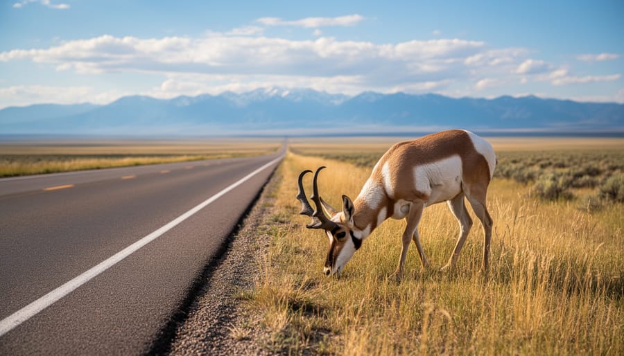
The grasslands flanking South Alamo Road create natural corridors for San Luis Valley wildlife, making the drive itself a quiet safari if you keep your eyes open. Pronghorn antelope are the stars here, you’ll often spot small herds grazing in the open flats during early morning and late afternoon. Their tan-and-white coloring stands out against the sage, and they’re surprisingly tolerant of slow-moving vehicles at a distance.
Watch the fence lines and scrubby areas for mule deer, especially around dawn and dusk when they emerge to feed. Overhead, red-tailed hawks and golden eagles patrol the thermals, riding updrafts along the bluff’s edge. If you’re lucky, a northern harrier might glide low across the fields, wings tilted in its distinctive hunting pattern.
Spring and fall bring peak wildlife activity. In spring, pronghorn fawns appear and migratory birds pass through; autumn sees elk occasionally wandering down from higher elevations, though that’s less common along this stretch.
Pull completely off the road if you stop to watch. Stay in your vehicle when animals are close, it’s less threatening than a human silhouette. Bring binoculars; approaching on foot almost always sends them running. And keep noise down. The quiet observer sees far more than someone slamming car doors and shouting directions.
4. Connecting Trail Access Points

Beyond the main South Bluff Trail, South Alamo Road provides access to several lesser-known connecting paths that reward explorers willing to venture further. About a quarter-mile past the primary trailhead, watch for an unmarked dirt pullout on the east side where a connector trail leads to the River Park Trail system, creating a roughly 4.5-mile loop back to town for those who arrange shuttle transportation.
More experienced hikers can tackle the Bluff Ridge Extension, a rugged 2.8-mile route branching north from the main trail’s halfway point. This demanding path climbs an additional 600 feet, offering exposed ridge walking with panoramic valley views but requiring solid navigation skills, cairns mark the way, but the trail isn’t maintained like the main route. Check our Colorado trail guide for more advanced hiking options in the region.
A third option, the South Valley Connector, splits off near the southern overlook and descends gradually toward County Road 104, appealing to mountain bikers and trail runners seeking a longer 7-mile one-way route with minimal elevation change.
Practical Travel Information
South Alamo Road is straightforward to navigate, though a few practical considerations will help you make the most of your visit. The trailhead sits roughly 4 miles south of downtown Alamosa, take Main Street south until it becomes State Highway 17, then watch for the clearly marked turn onto South Alamo Road heading east. The road itself is unpaved gravel for most of its length, generally well-maintained but subject to washboarding and occasional ruts after heavy rain or snowmelt.
| Detail | Information |
|---|---|
| Directions from Downtown | South on Main St/CO-17, turn east on South Alamo Rd, continue 2 miles to trailhead |
| Road Conditions & Vehicle | Unpaved gravel; passenger cars okay in dry conditions, high clearance recommended after storms |
| Parking | Small lot at main trailhead (8-10 vehicles); roadside overflow available |
| Fees | Free access, no permits required |
| Seasonal Access | Year-round; may be impassable during/after heavy snow or spring mud season |
| Facilities | No restrooms, water, or services; bring supplies from Alamosa |
Most passenger vehicles handle the road fine during dry conditions, but high-clearance vehicles fare better if you’re visiting after spring snowmelt or summer thunderstorms. Take it slow over rougher patches and drive safely loose gravel can surprise you on curves. The main trailhead parking area accommodates about ten vehicles; if it’s full, you’ll find informal pull-offs along the road within a short walk.
There are no facilities at the trailhead, so pack water, snacks, and anything else you’ll need before leaving town. Cell service is spotty to nonexistent once you’re on the bluff, making downloaded maps or a GPS unit worthwhile. General road safety tips apply: check your spare tire, bring extra water for your vehicle in summer, and let someone know your plans if you’re heading out solo. Winter and early spring can render the road impassable due to snow or mud, so call the Alamosa Visitor Center beforehand if conditions look uncertain.
When to Visit and What to Expect
The best time to drive South Alamo Road and hike the South Bluff Trail is during spring (April through early June) and fall (September through October), when temperatures are mild and skies are typically clear. Summer mornings from May through August offer pleasant conditions before afternoon heat intensifies, while winter access depends heavily on snowfall and road conditions.
For optimal lighting and cooler temperatures, plan your visit for early morning or late afternoon. Sunrise brings soft golden light across the valley and active wildlife, while sunset paints the Sangre de Cristo Mountains in brilliant colors and casts dramatic shadows across the bluffs. Midday visits work year-round but can be uncomfortably hot in summer and offer harsher lighting for photography.
Winter visitors should expect snow and ice on the road from November through March, making a high-clearance vehicle advisable and four-wheel drive necessary after storms. The unpaved sections become muddy during spring thaw and after summer thunderstorms, which typically roll in between 2-4 PM from July through early September.
Pack essentials for any season: at least one liter of water per person, sun protection, sturdy hiking shoes, and a windbreaker. Summer requires extra water and a hat, while shoulder seasons call for warm layers since temperatures can drop 30 degrees between afternoon and evening. Check local Alamosa weather forecasts before heading out, as conditions change quickly in the valley.
Local Tips from the Alamosa Community
Locals who frequent South Alamo Road have learned to time their visits for maximum impact and minimum hassle. The most experienced hikers swear by arriving at the trailhead before 7:00 AM, especially in summer, you’ll beat the heat, catch the morning light painting the Sangre de Cristos pink and gold, and often have the trail entirely to yourself. Sunset draws bigger crowds, but the light show across the valley is worth sharing the experience.
For provisions, stop at San Luis Valley Brewing Company or Calvillo’s Mexican Restaurant in town before heading out. There’s absolutely nothing along South Alamo Road itself, and cell service becomes spotty once you leave Alamosa proper. Pack extra water and snacks; the dry air and elevation dehydrate you faster than you’d expect.
Seasoned visitors recommend these insider strategies:
- Arrive by 6:30 AM for golden hour photography without competing for parking spots
- Grab coffee and breakfast burritos at Milagros Coffee House on Main Street beforehand
- Visit weekday mornings in May or September for solitude and mild temperatures
- Combine the South Bluff hike with an afternoon at the Alamosa National Wildlife Refuge for diverse scenery
One local habit worth adopting: bring binoculars. The overlooks along South Alamo Road offer exceptional raptor watching, particularly during spring and fall migrations when hawks and eagles ride the thermals above the valley. If you’re visiting during crane season (February through March), pair your South Bluff hike with an early morning or late afternoon trip to Monte Vista National Wildlife Refuge, about thirty minutes north. The combination makes for an unforgettable San Luis Valley experience that most tourists miss entirely.
Frequently Asked Questions
The most practical questions about visiting South Alamo Road tend to come up when folks are planning their trip or standing at the trailhead wondering if they made the right call. Here’s what visitors typically want to know before heading out.
Is South Alamo Road paved or do I need a high-clearance vehicle?
South Alamo Road is a maintained graded dirt road accessible to most vehicles in dry conditions, though a higher-clearance vehicle provides more confidence over the occasional washboard sections. After heavy rain or spring snowmelt, the road can develop muddy spots that make a truck or SUV the safer choice.
How difficult is the South Bluff Trail for beginners?
The main trail rates as easy to moderate with gentle elevation gain and wide, well-marked paths suitable for most fitness levels. The bluff overlook section does include a steeper climb but rewards hikers with expansive valley views, and you can turn back at any point if it feels too challenging.
Can I bring my dog on the trail?
Yes, dogs are welcome on the South Bluff Trail system and most visitors bring their pups along. Keep them leashed, pack out waste, and bring extra water since the high desert sun and dry air affect dogs quickly.
Will I have cell service on South Alamo Road and the trail?
Cell coverage is spotty to nonexistent once you leave the main Alamosa area, so download offline maps beforehand and let someone know your plans. This isn’t the place to count on GPS navigation or emergency calls without preparation.
Winter access varies year to year depending on snowfall, but the road typically stays passable for high-clearance vehicles with decent tires through much of the season. The valley’s relatively dry climate means snow melts off faster than in the surrounding mountains, though locals still recommend checking current conditions with the Alamosa Visitor Center before making the drive between December and March. Early mornings after a cold snap can leave the road icy in spots, so wait for the sun to warm things up if you’re uncertain about traction.
South Alamo Road is more than just a route to the trailhead, it’s part of the adventure itself. The drive offers sweeping valley views, wildlife encounters, and a genuine sense of place that defines the San Luis Valley. Take your time on the road, pack out what you pack in, and let this corner of Alamosa surprise you. Whether you’re chasing sunrise over the bluffs or searching for that perfect overlook, the road rewards curiosity and respect for the landscape. Get out there and see what makes this area special.