
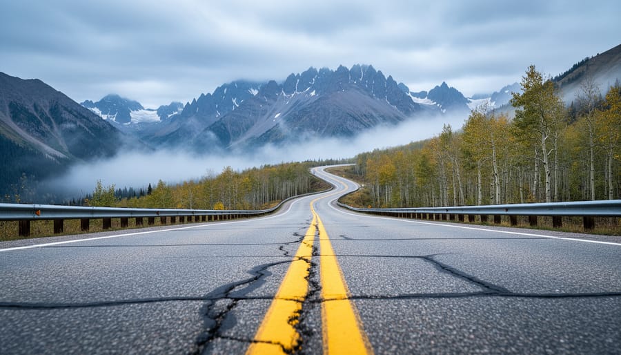
Highway 9 in Colorado isn’t scary for most drivers, but it demands respect. This winding two-lane mountain road stretches from Fairplay to Kremmling, climbing above 11,000 feet at Hoosier Pass, and while it doesn’t have the hair-raising exposure of some Colorado mountain highways, it combines steep grades, tight curves, and unpredictable weather that catch unprepared drivers off guard. The real question isn’t whether the road is objectively frightening, it’s whether you’re ready for genuine mountain driving conditions.
I’ve driven Highway 9 dozens of times, and I’ll tell you what most travel guides won’t: the scariest moments usually have nothing to do with the road itself. They happen when a driver from sea level attempts Hoosier Pass in a rental sedan during a June snowstorm, or when someone who rarely drives above 40 mph suddenly faces a 7% downgrade with no shoulder and a thousand-foot drop on the passenger side. The highway punishes poor preparation more than poor skills.
What makes Highway 9 manageable for confident drivers and nerve-wracking for others comes down to specific, predictable challenges. Weather shifts happen fast at elevation. Wildlife crossings are frequent, especially at dawn and dusk. Cell service vanishes for long stretches. And in winter, black ice forms in shaded sections while sunny spots remain dry, creating a patchwork of traction that changes every quarter mile.
If you’ve driven mountain roads before and understand how to use low gears on descents, you’ll likely find Highway 9 beautiful rather than terrifying. First-timers should know exactly what they’re getting into.
What Makes Highway 9 Feel Intimidating
Hoosier Pass: The Heart of the Challenge
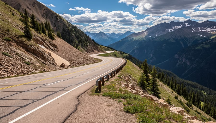
Hoosier Pass sits at 11,542 feet, making it the highest point on Highway 9 and the primary reason this route earns its intimidating reputation. This isn’t a gentle summit crossing. The approach from either direction involves sustained climbing with grades reaching 6-7%, and the southern ascent from Alma packs in tight switchbacks that feel more dramatic than the numbers suggest.
What rattles drivers isn’t just the elevation, it’s the combination. You’re navigating curves while your engine works harder in thin air, and passengers might feel lightheaded from altitude. The Hoosier Pass switchbacks and grade demand constant attention because there’s little room for error. Guard rails exist in critical spots, but many sections rely on nothing more than painted lines between asphalt and significant drops.
The pass itself stretches about four miles from base to summit on the south side, with the steepest sections concentrated in the final two miles. Visibility varies wildly, some curves let you see the road ahead winding up the mountain, while others hide what’s coming until you’re already committed to the turn. Heavy vehicles struggle here, especially older RVs and trucks towing trailers, which means you’ll likely encounter slow-moving traffic adding another layer of complexity.
First-timers often fixate on the drop-off side, which ironically makes steering harder. The roadway itself is well-maintained and wide enough for two lanes, but that psychological edge, knowing there’s 500 feet of nothing just beyond the shoulder, triggers anxiety even in experienced mountain drivers. Your hands grip tighter, your breathing changes, and suddenly a routine mountain pass feels genuinely challenging.
Narrow Shoulders and Drop-Offs
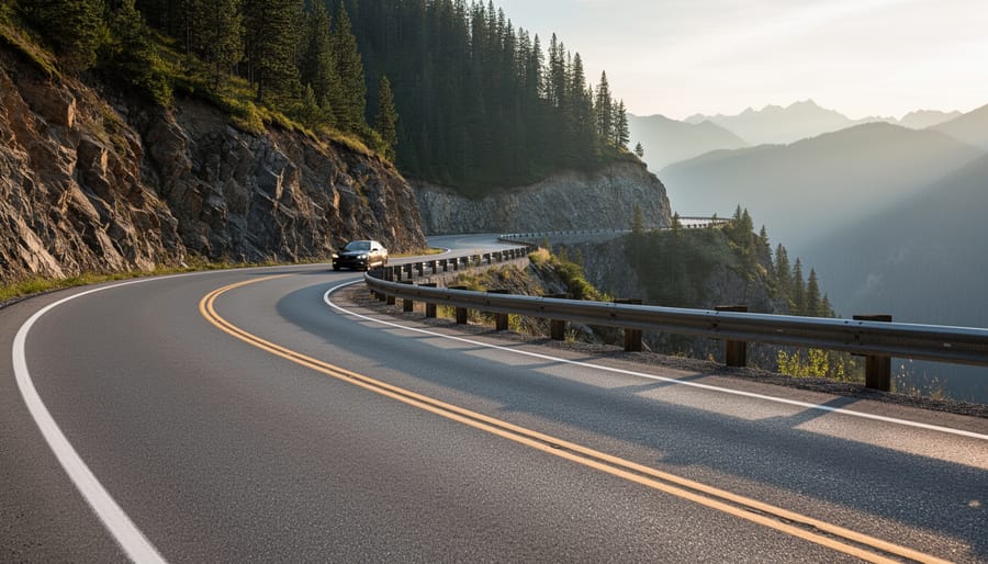
The stretch between Alma and Fairplay presents Highway 9’s most psychologically challenging terrain. Here, the road narrows to barely enough space for two vehicles to pass comfortably, with shoulders that shrink to mere inches in places. On the passenger side, the ground drops away sharply, sometimes hundreds of feet down rocky slopes with minimal guardrails.
This configuration creates what safety experts call “edge drop anxiety.” Your brain processes the proximity of that drop-off constantly, making the drive feel more dangerous than it statistically is. Many drivers report an almost magnetic pull toward the centerline, overcorrecting away from the edge unconsciously.
The reality? Thousands of vehicles navigate these sections daily without incident. The road itself is wide enough for safe travel at reduced speeds. What amplifies the fear is the visual: you can see exactly how far you’d fall, unlike tree-lined roads where vegetation obscures the drop.
Northbound drivers face the mountain side, which most find less stressful. Southbound travelers get the full exposure to those drop-offs. If you’re nervous, consider timing your drive to put you northbound through this section, or simply focus on the white line nearest your vehicle rather than scanning the void beyond the shoulder.
Seasonal and Weather Hazards on Highway 9
Winter: When ‘Scary’ Becomes Real
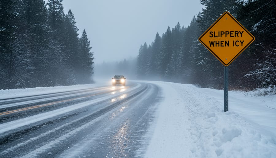
Winter transforms Highway 9 from challenging to genuinely dangerous. Between November and April, this route earns its place among Colorado’s most treacherous roads through a perfect storm of mountain hazards that can overwhelm even experienced drivers.
Black ice is the silent killer. Hoosier Pass stays shaded through winter mornings, creating invisible ice patches that form overnight and persist past sunrise. You’ll hit them without warning, usually in corners where you need traction most. Four-wheel drive doesn’t help you stop on ice, it just gets you moving faster before you lose control.
Blizzards shut down Highway 9 with startling speed. Visibility drops to ten feet within minutes as winds whip across the pass. You can’t see the road edges, can’t judge where other vehicles are, and GPS becomes useless when you’re navigating by feel. CDOT closes the highway during severe storms, but closures often happen after drivers are already stranded between Alma and Breckenridge.
Avalanche zones add genuine life-threatening risk. The western slopes above Hoosier Pass are active slide paths. Red Mountain Pass gets more attention, but Highway 9 sees regular avalanche activity that can bury vehicles. CDOT monitors these zones, but natural slides happen between control work.
The temperature swings matter too. A 20-degree morning becomes a 45-degree afternoon, turning packed snow into slush, then refreezing as black ice after sunset. This freeze-thaw cycle makes conditions unpredictable and road surfaces inconsistent within the same drive.
Summer Afternoon Thunderstorms
Colorado’s summer thunderstorms follow a predictable but dangerous pattern on Highway 9. Clear morning skies typically give way to towering thunderheads by early afternoon, especially between June and August. These storms build fast, what looks like a distant cloud at noon can unleash lightning, hail, and torrential rain by 2 PM.
The danger intensifies above treeline near Hoosier Pass, where you become the tallest object for miles. Lightning strikes without warning on these exposed ridges, and there’s nowhere to hide. Hail can transition from light rain to golf-ball-sized ice in seconds, cracking windshields and reducing visibility to near zero.
Flash flooding poses another serious risk. Summer downpours overwhelm the ground’s ability to absorb water, turning roadside ditches into raging streams and creating debris flows across the pavement. Low sections of Highway 9 can flood within minutes of heavy rain beginning.
The solution is simple but requires discipline: start your drive early. Aim to cross Hoosier Pass before noon, and if you see dark clouds building, find a safe spot to wait out the storm rather than pushing through.
Who Should (and Shouldn’t) Worry About Highway 9
If you’ve driven mountain passes before and handled switchbacks, steep grades, and changing weather without white-knuckling the steering wheel, Highway 9 probably won’t faze you. Experienced mountain drivers who’ve tackled routes like Independence Pass or Trail Ridge Road will find Highway 9 manageable, especially in summer and fall. Those comfortable with roads where you can see the edge and feel elevation changes typically handle this drive without significant stress.
First-time mountain drivers, on the other hand, should approach Highway 9 with healthy caution. If you’ve only driven highways through flat terrain or gentle hills, Hoosier Pass will feel dramatically different. The combination of elevation, narrow lanes, and visible drop-offs can overwhelm drivers who haven’t developed the mental calibration for mountain roads. That doesn’t mean you can’t do it, but your first Colorado mountain pass shouldn’t be in a snowstorm.
People with a genuine fear of heights face a tougher call. Highway 9 has sections where you’ll see steep slopes alongside the road, particularly between Alma and Fairplay. Some travelers with height anxiety manage fine by staying focused on the road ahead rather than looking at the edges. Others find the exposure genuinely distressing. If scenic overlooks make you uncomfortable, Highway 9’s sustained elevation might trigger more anxiety than brief overlook moments elsewhere.
Weather timing matters enormously for self-assessment. A confident summer driver might reasonably avoid Highway 9 in January, when even locals drive cautiously or choose alternatives. Checking month-by-month road timing helps you understand seasonal patterns and plan around Colorado’s harshest conditions.
Vehicle matters too. Driving a compact car feels different than piloting a large RV or towing a trailer. Larger vehicles amplify every curve and grade, making an already challenging road genuinely demanding. If you’re in a rental car or unfamiliar vehicle, add that variable to your comfort assessment.
Bottom line: Highway 9 rewards honest self-evaluation. Overconfidence causes problems, but so does excessive anxiety. If you’re uncertain, drive it in ideal conditions first, or choose an alternative route without shame.
Practical Tips for Driving Highway 9 Safely
Before You Go: Preparation Essentials
Check CDOT’s road conditions website or call 511 before you leave, Highway 9’s status can change within hours, especially during shoulder seasons. Winter closures happen fast when storms hit Hoosier Pass.
Fill your tank in Breckenridge, Fairplay, or Silverthorne. Gas stations thin out between towns, and you’ll burn more fuel climbing to 11,542 feet. Running low at altitude, in winter, is dangerous.
Pack these essentials: water, high-energy snacks, a fully charged phone, a physical map (cell service is patchy), a first-aid kit, blankets, and a flashlight. Winter demands an ice scraper, extra layers, gloves, a shovel, and sand or kitty litter for traction if you get stuck.
Time your drive for mid-morning to early afternoon. You want daylight, warmer pavement, and visibility. Summer afternoons bring thunderstorms after 2 PM, so finish Hoosier Pass by then. If you’re travelling on a major weekend, leave early to avoid holiday traffic that clusters on the pass.
Tell someone your route and expected arrival time. If something goes wrong on a remote stretch, you want people looking for you in the right place.
Behind the Wheel: Technique and Strategy
The most critical technique on Highway 9 is managing your speed on descents without overheating your brakes. Use a lower gear, typically second or third in an automatic, or one to two gears below your climbing gear in a manual, to let engine braking do the work. Your brakes should be for fine adjustments, not constant pressure. If you smell burning brakes, you’re riding them too hard.
Focus your eyes on the road ahead, not the drop-off. Your vehicle naturally drifts toward wherever you’re looking, so staring at the edge becomes a self-fulfilling anxiety. Pick a focal point two to three seconds ahead on the pavement and trust your peripheral vision to handle the rest. This single adjustment calms most nervous passengers and drivers.
Take the outside lane position through curves when safe, staying closer to the mountain side rather than the edge gives you more margin for error and reduces the psychological impact of the drop. Don’t accelerate mid-turn trying to “get through it faster.” Steady speed through the apex is safer and smoother.
Pull over at designated turnouts if you’re uncomfortable, if faster traffic is stacking up behind you, or if you need a moment to breathe. There’s zero shame in taking breaks. The truly dangerous driver is the one who white-knuckles through panic rather than acknowledging they need a pause.
Comparing Highway 9 to Other Dangerous Colorado Roads
Highway 9 ranks solidly in the middle tier among Colorado’s most dangerous roads. It’s more challenging than everyday mountain highways like I-70, but less extreme than the truly notorious routes that make even experienced drivers nervous.
| Route | Max Elevation | Difficulty Level | Primary Hazards |
|---|---|---|---|
| Highway 9 (Hoosier Pass) | 11,542 ft | Moderate | Winter ice, narrow shoulders, high elevation |
| Million Dollar Highway (US 550) | 11,018 ft | High | No guardrails, sheer cliffs, rockfall |
| Independence Pass (CO 82) | 12,095 ft | High | Extreme narrowness, hairpin turns, closed in winter |
| Guanella Pass | 11,669 ft | Moderate-High | Steep grades, unpaved sections, weather exposure |
The Million Dollar Highway between Silverton and Ouray features more dramatic exposure with unguarded drop-offs of hundreds of feet, making it objectively more dangerous than Highway 9’s relatively protected shoulders. Independence Pass closes entirely November through May because its narrow, twisting route becomes impassable, whereas Highway 9 stays open year-round, a testament to its more manageable design despite the elevation.
What sets Highway 9 apart is accessibility. Unlike remote passes that require significant detours, Highway 9 serves as a direct route between popular destinations, meaning less-experienced drivers attempt it more frequently. The combination of moderate difficulty with high traffic volume creates its own unique risk profile. You’re sharing the road with everything from rental sedans to oversized RVs, and not everyone driving it has mountain experience.
If you can handle Highway 9 confidently, you’re prepared for about 60 percent of Colorado’s mountain passes. The truly scary roads demand another level of skill and nerve entirely.
Common Questions About Highway 9 Safety
Is Highway 9 open year-round?
Yes, Highway 9 stays open throughout the year, but winter closures can happen temporarily during severe storms or avalanche control work at Hoosier Pass. Always check CDOT road conditions before you go between November and April.
What’s the best alternative route if I’m too nervous to drive it?
US 285 offers a lower-elevation option that bypasses Hoosier Pass entirely, though it adds time to your journey. If you’re traveling between Denver and Summit County, I-70 is the most maintained option, or you can scenic train alternatives and take the train through the mountains instead.
What should I do if I get stuck or have car trouble on Highway 9?
Pull as far off the road as safely possible, turn on hazards, and call for help, cell service is spotty but usually available near Hoosier Pass. In winter, stay with your vehicle and run the engine periodically for heat while waiting for assistance.
How does Highway 9 compare to I-70 in terms of difficulty?
Highway 9 feels more exposed and remote than I-70, with tighter curves and less shoulder space, but I-70 actually sees more accidents due to higher traffic volumes and speed. If you can handle I-70 through the Eisenhower Tunnel confidently, Highway 9 shouldn’t be a problem in good weather.
Beyond these common concerns, many travelers wonder whether kids or nervous passengers will struggle with the drive. The answer depends less on age and more on motion sensitivity and fear of heights. If your passenger gets carsick on winding roads, consider giving them the front seat and having them focus on the horizon rather than looking down. For height-anxious passengers, sitting on the mountain side rather than the drop-off side helps significantly.
The “what if” scenarios often loom larger than reality. Thousands of locals drive Highway 9 daily without incident, treating it as their regular commute. The key difference between a scary experience and a manageable one usually comes down to preparation and realistic expectations, not the road itself.
So, is Highway 9 scary? That depends entirely on who’s driving and when. For someone comfortable with mountain roads, traveling in summer with clear skies, it’s a beautiful drive that presents no real issues. But for a nervous driver facing their first Colorado pass, or anyone attempting it during a winter storm, yes, it can be genuinely intimidating and even dangerous.
The key is honest self-assessment. If you’ve never driven steep grades or narrow mountain roads, Highway 9 isn’t the place to start. There’s no shame in taking US-285 or I-70 instead. Those routes get you where you’re going without the white-knuckle moments, and that’s a perfectly reasonable choice.
If you do drive Highway 9, respect what it demands: attention, preparation, and a willingness to pull over or turn back when conditions deteriorate. The pass doesn’t care about your schedule or your pride.
We’d love to hear from drivers who’ve tackled this route. What was your experience? Did Highway 9 live up to its reputation, or did you find it easier than expected? Share your story in the comments, your insights help other travelers make informed decisions about whether this scenic but challenging road is right for them.